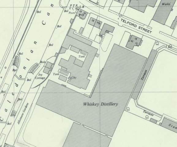
1969 Glen Mhor Map
Scotland's first whiskey distillery?
It's a common mistake and similar errors surround the Glen Mhor or Glenmore name of the distillery, even extending to its pronunciation. This from what I've researched, extends to the distillery team, some of who preferred to say Glen More, and at the end of the day, we all know what they mean... plus, it's what it produces that matters.
This is the final layout of the distillery as we know it unless our ongoing research throws a few unexpected twists into the timeline.
Spelling aside, there are a couple of interesting aspects to this version of the distillery. We have a couple of tanks that were not previously noted on maps in our in-depth map section, which has just been refreshed.
This aerial image was taken during the 1960s and appears in our photograph section, I've enhanced the original and zoomed in, to give us a similar perspective to the above map:
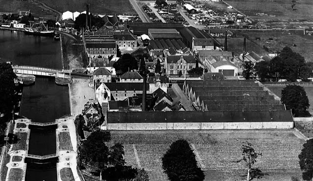
The image underlines how confined the site had become with only the long-established Muirtown nursery to the south of the site offering any hope of expansion. This would have meant some demolition through the original warehouse which stretches along the south boundary of the site. Sadly, this was not to be or even considered a possibility on research so far and it is today residential housing.
The map does clearly show the Saladin Boxes extension to the north of the original malts, as shown by this map just a couple of years prior in 1962:
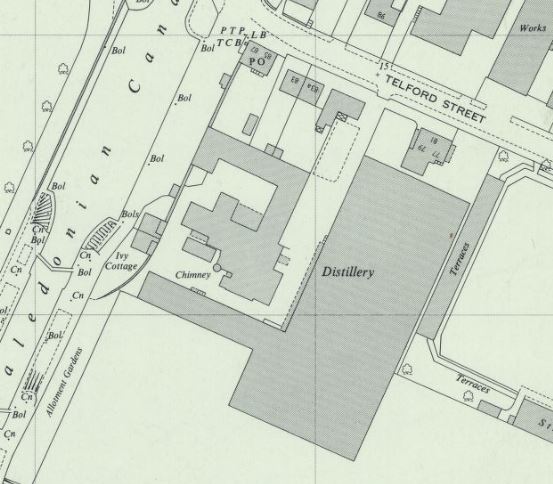
The south side of the original maltings building also features new additions, if you compare the above to the lead map, you'll notice the activity that was focused on this distillery building. The maltings were a limitation of Glen Mhor, as we've revealed in this document from 1949, they were not large enough to support the needs of the distillery, with Glen Albyn often filling in - that must have been fun trying to get across an increasingly busy Telford Street.
This map marks the completion of our map section until any new information appears.
Comments
Post a Comment